Matt Sustek teaches the Lidar and its incredible uses
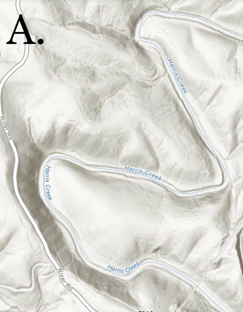
When it comes to metal detecting, there are many tools and resources you can use to better your experience and increase the quantity of relics found. These include but are not limited to old maps, the library of Congress and its archives and even word of mouth. But there is one thing that I have used for over a decade that is crucial in pinpointing unnatural occurrences or abnormalities in the landscape that lead me to better sites and better outcomes. The process of using the LiDAR application has proven to be instrumental in finding these abnormalities that aren’t visible to the naked eye most of the time when using things like google maps. LiDAR stands for light detection and ranging. What this is, is light in the form of a pulse laser from above the Earth is shot down to detect even the slightest change in elevation, or deformities in the earths surface. This gives small slopes, depressions, and changes in elevation different shades of gray and white. Even small rock piles show up. Photo A is a simple example showing you a darker shaded area next to the creek by my house and the lighter shaded areas. You can see the complexity of creeks, ravines, and even the slightest little mounds and divots. Simply put it is like a topographical map without the contour lines.
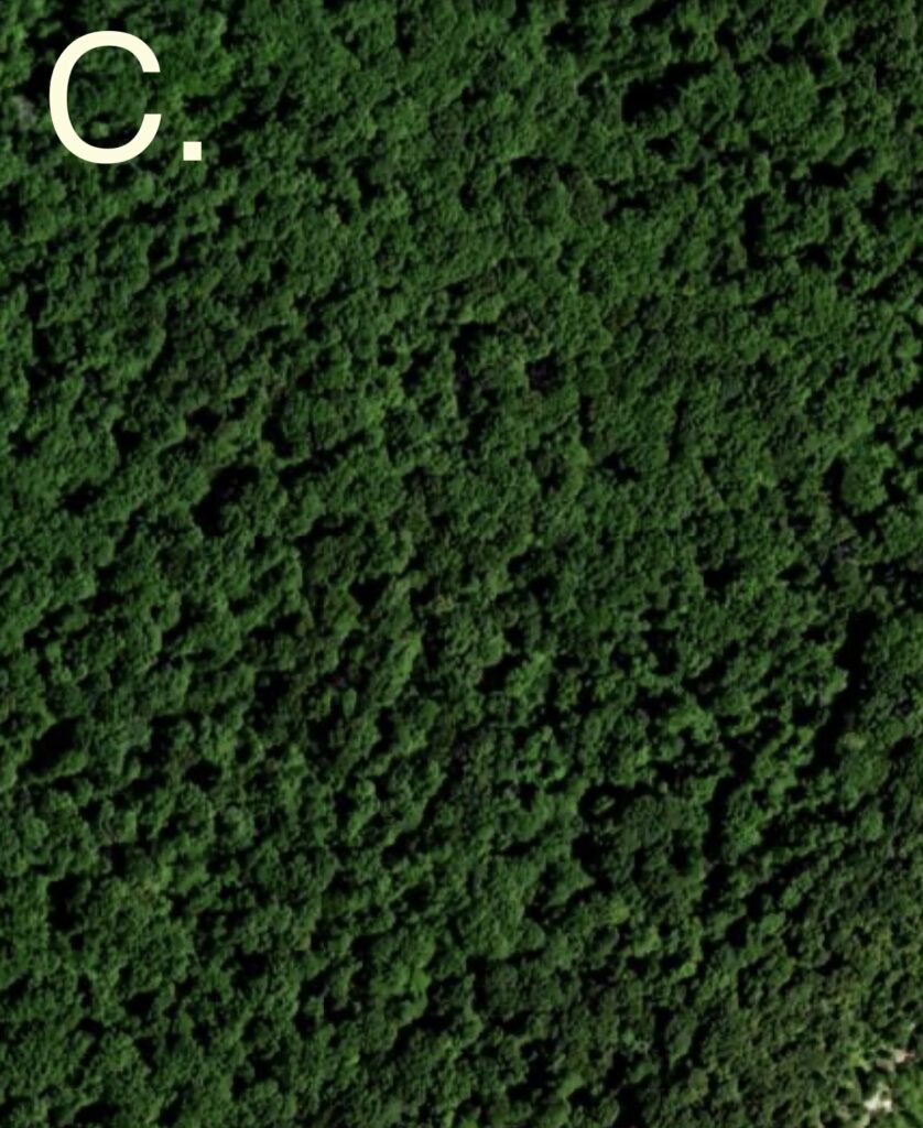
Now, how does this relate to searching for relics. I grew up in northern va just below the Appalachian trail. I had permissions spanning the entirety of most of the mountains in the area. IT was WAY to much ground for me to scout for hotspots of relics. When I learned about LiDAR the game totally changed. I then scanned over all of my mountain side permissions and was able to locate multiple road beds, un-natural occurrences like flattened earth, stone piles, and old homesites. Following these road bed networks up and down the mountain it put me on more than a dozen homesites. These long forgotten dwellings were all linked by these road beds that were clear as day when using the LiDAR application. For example: Photo B was the first home sites I located. You can clearly see a road bed running north and south along the mountain with not only one, but two oddly flattened areas right along the path. They both turned out to be massive stone piles, that were once pre civil war structures. These sites turned out to be virgin and produced some of the most unique and interesting relics I have ever gotten into. What’s incredible about it is photo C shows what a normal person is viewing on google maps looking at the same spot. A mass of endless trees.

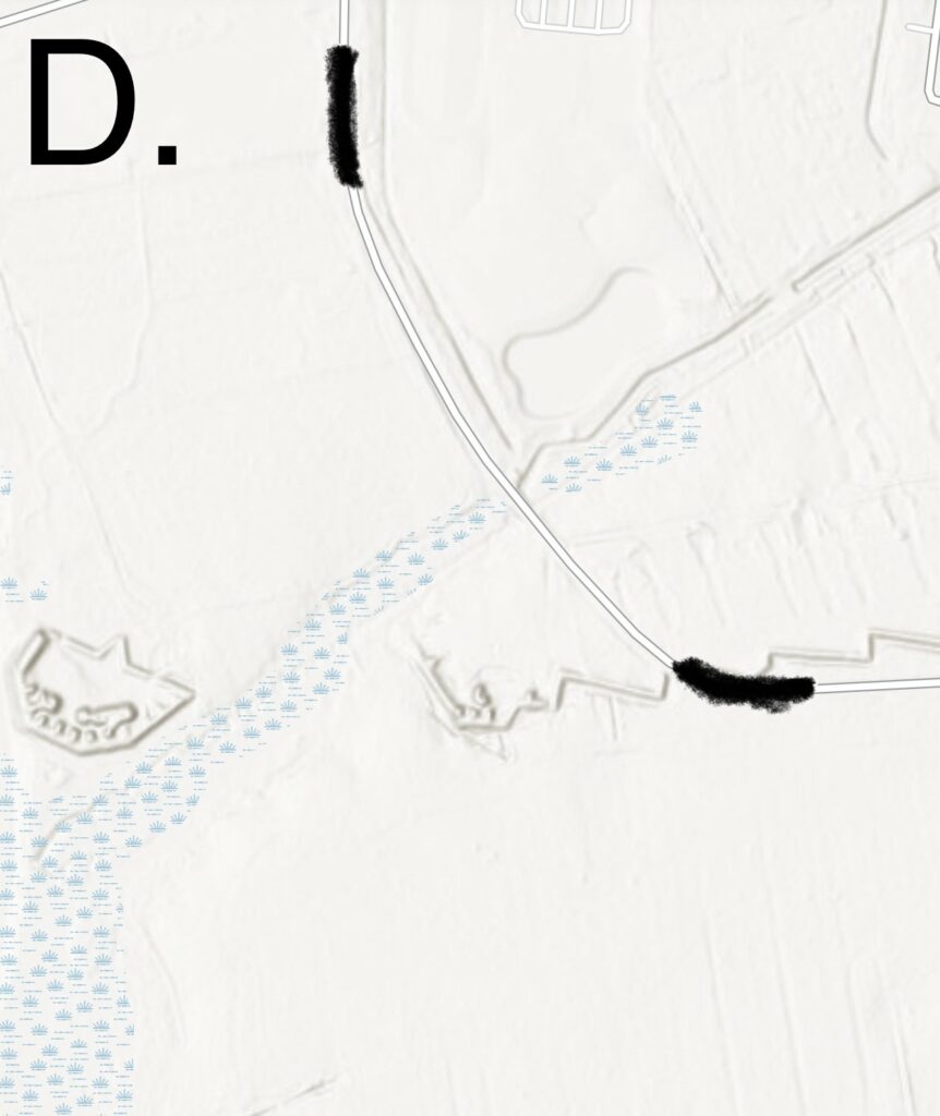
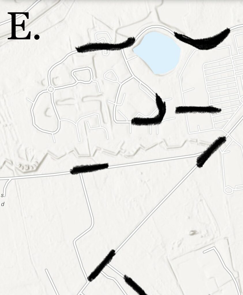
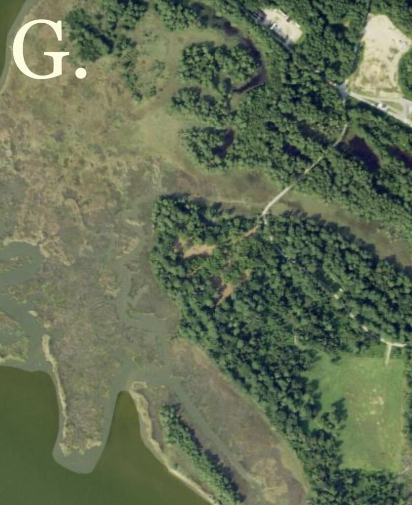
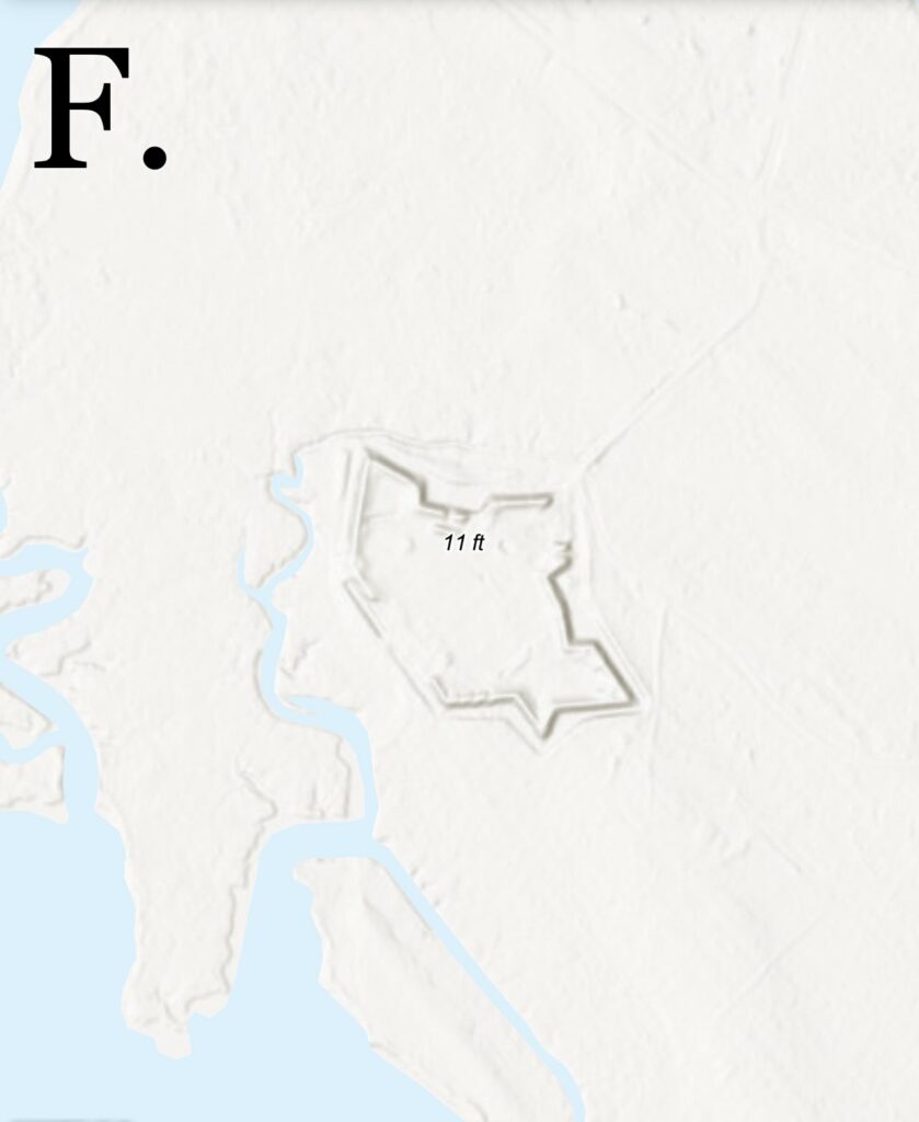
Let’s take a second to look at some super prominent civil war earthworks from South Carolina. Photo D, and E is a well known fort in Charleston South Carolina. You can clearly see the entire detail of the forts layout, as well as the trench line running away from it. Photo F is a fort on the southern Virginia coastline. Note the shape. Notice what you can and cannot see in comparison with both photos! (F and G) are the same spot.
The link for the LiDAR application is: https://vgin.vdem.virginia.gov/apps/VGIN::virginia-lidar-downloads/explore
Once opened you can uncheck the blue boxes (Virginia LiDAR flight year) and (Virginia LiDAR inventory downloads) to help clean up what you are viewing and literally go anywhere you would like. Note though, some areas are not as well as others. I am not sure if this is due to the actual deficiencies in the scanning they did or the site not loading properly. But most areas are well enough. If you click the layers button up top you can switch through various views: topographical, oceans, NAIP imagery, etc. My most used layer is “terrain with labels”. This seems to give the most contrast in colors and shading and make seeing abnormalities even easier.
Other resources
Another great mobile application is CAL TOPO. It was developed by a California fireman for the use of wildland firefighting. Well it turns out to be an amazing tool for most of the country for LIDAR usage. The only problem is it can be very dependent of cell phone service.
CAL TOPO- For APPLE and Android
https://apps.apple.com/us/app/caltopo/id1460038458
https://play.google.com/store/search?q=CALTOPO&c=apps&hl=en_US&gl=US
Written by Matt Sustek
A huge shout out to Matt for sharing some of the tools he uses to be successful in the field.